Leen Helmink Antique Maps
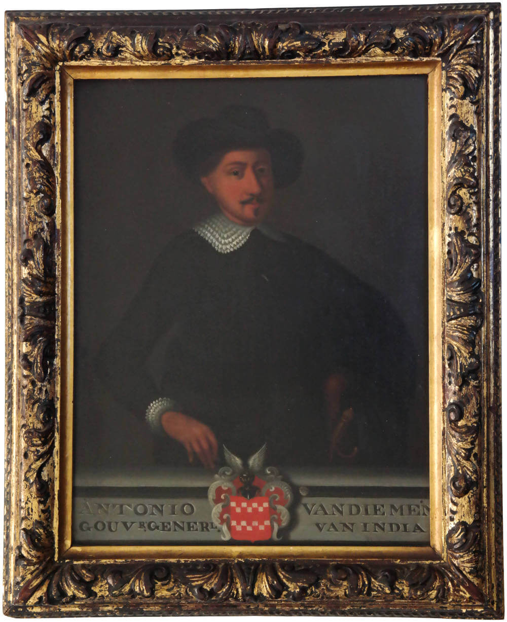
VOC State Portrait of Anthony van Diemen
The item below is on hold, but if you enter your email address we will notify you in case it becomes available, or if we have another example that is not yet listed, or as soon as we receive another example.
Stock number: 19236
Zoom ImageCartographer(s)
Matthijs Balen (biography)
Title
ANTONIO VAN DIEMEN GOUVR. GENERL. VAN INDIA
First Published
Batavia (1636) - Dordrecht, 1726
Size
33.0 x 25.8 cms
Technique
Condition
excellent
Price
This Item is On Hold
Description
Half-length painting of Antonio van Diemen (1593-1645), VOC Governor General of the Dutch Indies 1636-1645.
Patron of Discovery and Exploration of Australia.
One of originally six official VOC State portraits of him, one for each VOC chamber.
Oil on copper, 33 x 25.8 cm, ca 1726-29. In its original frame.
Subscript: ANTONIO VAN DIEMEN || GOUVR. GENERL. VAN INDIA
with his coat of arms.
Annotated on dorso: ‘8’ [being the eighth portrait of the series]
Attributed to: Matthijs Balen, Dordrecht 1684 – 1766.
Provenance: One of the six chambers of the Dutch East India Company.
Upon appointment, a life size portrait was painted of each governor general to be included in the portrait gallery in Batavia Castle’s council room. Van Diemen’s principal portrait of 1636 is now in the Amsterdam Rijksmuseum collection, but unfortunately in painfully poor condition (also online here).
Somewhere between 1726-1729, the VOC commissioned six reduced size versions of the series of portraits of the consecutive governor generals who had served until that time, in order to uniformly decorate the council rooms of the six VOC chambers in the Netherlands.
The task was almost certainly consigned to Matthijs Balen, who had just designed the same portraits for Valentijn's Oud en Nieuw Oost-Indien, a comprehensive book about the VOC and the East Indies that greatly pleased the Gentlemen Seventeen.
Two of these painted portrait series have survived,
- one in Amsterdam Rijksmuseum (from the VOC chamber Amsterdam) and
- a second one in Amsterdam Tropenmuseum (from an unidentified VOC chamber), (also online here).
- a third series was destroyed in 1931 when the Dutch pavilon in the World Exhibition in Paris burned to the ground, annihilating what was considered the most valuable and important cultural art collection.
The other three series have been lost or disseminated, following the bankruptcy of the VOC in 1799. The two series in Rijksmuseum and Tropenmuseum are nearly complete and both include the portrait of Antonio van Diemen, making the oil painting portrait offered here the third known surviving example of original six.
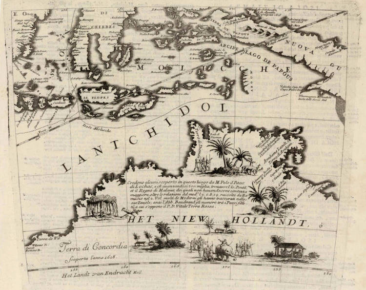
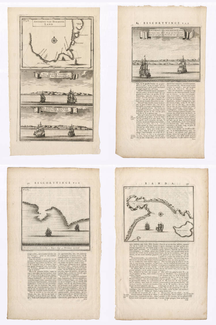
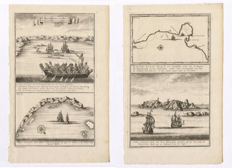
Antonio van Diemen’s name is forever connected to the exploration of the Fifth Continent and to the discovery of Tasmania, which was named Van Diemen’s Land by Abel Tasman when he first sighted it in November 1642. For centuries, the inhabitants of Tasmania were known as “Van Diemonians”, though contemporaries also used the spelling “Vandemonian”. Van Diemen’s name is further commemorated in Van Diemen Gulf on the coast of northern Australia, which Tasman explored and named on his second voyage of 1644.
The name of Antonio van Diemen’s wife Maria is perpetuated by Maria Island, named by Tasman, as well as in the name of the westernmost point of the North Island of New Zealand, Cape Maria van Diemen, also named by Tasman.
Antonio van Diemen’s meticulous planning and documentating of the exploration of the Southland has survived, with for instance
- the resolution for Tasman’s first voyage of 1642-43
- the instructions for Tasman and for chief pilot Frans Visscher and for the Council of the ships
- the memorandum by Frans Visscher
- the missive for the Gentlemen XVII in Holland
- the freight lists for the ships
- the daghregisters (daily journal entries) of Batavia Castle
- the resolution for Tasman's second voyage of 1644
- the instructions for the second voyage
- etc.
The documents show that van Diemen had the voyages extremely well prepared, and the resolution and instructions show his leadership and vision to unravel once and for all the true nature of the Southland. A third voyage was planned by van Diemen, but his death in 1645 impeded such an enterprise.
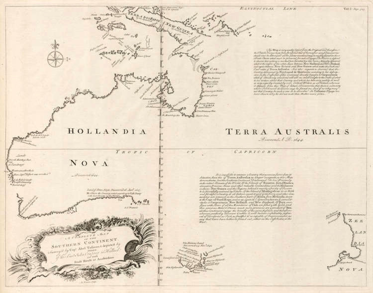
The Bonaparte Tasman map of 1644, now in the State Library of New South Wales, and one of the most important Tasman icons, is dedicated to Antonio van Diemen who ordered and planned the Tasman voyages.
The Bonaparte map is perhaps Australia’s greatest treasure of its history of exploration, and a mosaic version, composed of coloured marble and glass, including the dedication to van Diemen, was inlaid in the vestibule floor of the Library (also online here).
Just as these voyages were celebrated in marble and copper in the floor of the Groote Burgerzaal in the new Amsterdam City Hall built in 1648-50, prominently naming Terra Dimensis (Van Diemens Landt).
Selected Literature
van der Kraan, Alfons, Anthony van Diemen: from bankrupt to Governor-General, 1593-1636 (Part I), The Australian Association for Maritime History, The Great Circle, Vol. 26, No. 2 (2004), pp. 3-23.
van der Kraan, Alfons, Anthony van Diemen: Patron of Discovery and Exploration, 1636-45 (Part II), The Australian Association for Maritime History, The Great Circle, Vol. 27, No. 1 (2005), pp. 3-33.
Heeres, J.E., Abel Janszoon Tasman’s Journal and his discovery of Van Diemens Land & New Zealand in 1642, with documents relating to his Exploration of Australia in 1644. Amsterdam, 1895.
Matthijs Balen (1684-1766)
Matthijs (or Matthys) Balen (1684, Dordrecht - 1766, Dordrecht) was an 18th-century painter and artist from the Northern Netherlands.
Married in Dordrecht on 20 May 1728 to Maria van Bavel (1694-1773), he was the son of Jan Mathijsz Balen (born 1647) and Digna Schepens (1649-1729). He was the grandson of the Dordrecht author Matthys (Mathias) Balen (1611-1691), who wrote Beschryvinge der stad Dordrecht in 1677.
He was a registered and capable apprentice of Arnold Houbraken (1660-1719), and like him, became a printmaker as well as a painter. He lived in The Hague from 1705–1715 and is known for his portraits, Italianate landscapes, and historical allegories. Houbraken himself had been a pupil of Samuel van Hoogstraten and was friends with Romeyn de Hooghe, both of whom had assisted the elder Balen with poems and etchings for his 1677 book on the city of Dordrecht.
Related Categories
Antique maps of the East India Company
Old Master Prints
Antique maps of Australia
Antique maps of Japan
Antique maps of China
Antique maps of the Philippines
Antique maps of Southeast Asia
Antique maps of India and Ceylon
Antique maps of the Middle East
Antique maps of Asia
Antique maps of Africa
Old books, maps and prints by Matthijs Balen
Related Items
