Leen Helmink Antique Maps & Atlases
www.helmink.com
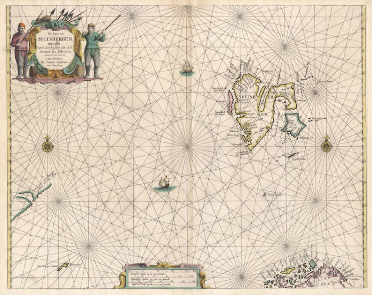
van Loon - Pas-kaert van Spitsbergen
Certificate of Authentication
This is to certify that the item illustrated and described below is a genuine and
original antique map or print that was published on or near the given date.
Dr Leendert Helmink, Ph.D.
Cartographer
Johannes van Loon
First Published
Amsterdam, 1661
This edition
1668
Size
42.5 x 54.5 cms
Technique
Copper engraving
Stock number
18758
Condition
excellent
Description
Johannes van Loon's very rare sea chart of Spitsbergen, where the Norwegians, the English, the Russians and the Dutch had a whaling station. The chart also includes the North Cape and Jan Mayen.
All charts by Joannes van Loon's Sea Atlas are of exceptional rarity.
Johannes van Loon (1611-1686)
"Joannes van Loon was an accomplished mathematician and astronomer. His first cartographic involvements were with Theunis Jacobsz during the 1640s. From 1650 he worked with Joannes Janssonius, engraving amongst other worksthe plates for his Celestial Atlas by Cellarius, 1660.
In 1661 he published his first work with his brother, Gillis; the 'Zee Atlas' contained thirty-five maps. In 1666 the plates were Jan Jansson van Waesberge, with whom he then co-published the atlas. This edition was expanded to forty-seven maps, and by 1676 there were fifty."
(Burden)