Leen Helmink Antique Maps
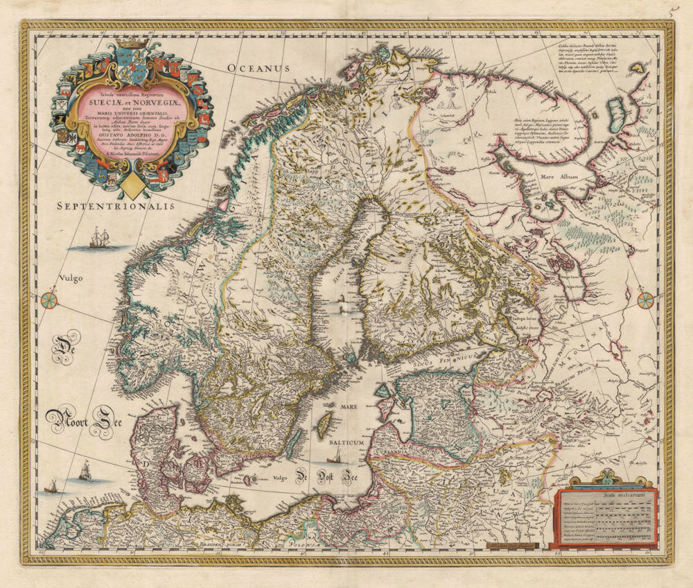
Antique map of Scandinavia by Visscher after Buraeus
Stock number: 18885
Zoom ImageCartographer(s)
Claes Janszoon Visscher (biography)
Title
Tabula exactissima Regnorum SUECIAE et NORVEGIAE, nec non Maris Universi Orientalis Terrarumq, adjacentium. summo studio ab Andrea Bureo Sueco
First Published
Amsterdam, 1630
This Edition
1658
Size
46 x 54.5 cms
Technique
Condition
mint
Price
$ 1,250.00
(Convert price to other currencies)
Description
Nicolaes Visser's very decorative map of Scandinavia and the Baltic. The plate was engraved in 1630 by Abraham Goos, and first published in the 1630 atlas appendix by Jansson.
The map is based on the 1626 wall map of Scandinavia in six sheets by Andreas Buraeus (Anders Bure), "the father of Swedish cartography". The map is dedicated to Gustav Adolf, King of Sweden.
A pristine collector's example, in beautiful original color.
Claes Janszoon Visscher 1587-1652
Nicolaes Visscher I (son) 1618–1679
Nicolaes Visscher II (grandson) 1649-1702
Elisabeth Visscher (widow of N. Visscher II)
"For nearly a century the members of the Visscher family were important art dealers and map publishers in Amsterdam. The founder of the business, Claes Janszoon Visscher, had premises near to those of Pieter van den Keere and Jodocus Hondius whose pupil he may have been.
From about 1620 he designed a number of individual maps, including one of the British Isles, but his first atlas consisted of maps printed from plates bought from van den Keere and issued as they stood with some additions of his own, including historical scenes of battles and sieges for which he had a high reputation.
Some maps bear the latinized form of the family name: Piscator. After Visscher's death his son and grandson, both of the same name, issued a considerable number of atlases, constantly revised and brought up to date but most of them lacking an index and with varying contents.
The widow of Nicholaes Visscher II carried on the business until it finally passed into the hands of Pieter Schenk."
(Moreland & Bannister).
