Leen Helmink Antique Maps
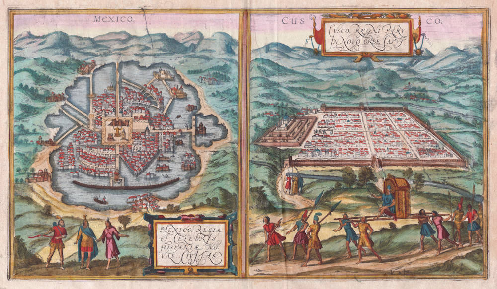
Antique map of Mexico and Cuzco by Braun and Hogenberg
Stock number: 18814
Zoom ImageCartographer(s)
Georg Braun and Frans Hogenberg (biography)
Title
Mexico / Cusco
First Published
Cologne, 1572
This Edition
1572 or later
Size
27 x 48 cms
Technique
Condition
excellent
Price
$ 2,250.00
(Convert price to other currencies)
Description
The only view of cities in the New World in Braun & Hogenberg's Civitates Orbis Terrarum, the foremost city atlas of the 16th Century.
The map of Mexico City, capital of the Aztec empire, is based on the first printed map of the city by the conquestador Hernán Cortés, who presented it in his letters to his Emperor Charles V.
The Cusco map goes back to earlier versions by Munster and Ramusio, and is based on Pizarro's accounts of the conquest of the Inca empire. The Inca emperor Atahualpa, who was ambushed and later killed by the Spanish, is depicted in the foreground.
Georg Braun (1541-1622)
Frans Hogenberg (c.1536-1588)
In 1572 Frans Hogenberg, who engraved maps for Ortelius, together with another noted engraver of the time, Georg Hoefnagel, compiled and issued in Cologne a City Atlas intended as a companion work to Ortelius' "Theatrum Orbis Terrarum". Entitled "Civitatis Orbis Terrarum" and edited by Georg Braun, the six volumes of this famous work were issued between the years 1572 and 1618 and contained in all more than 500 city plans and views.
The atlas provides a fascinating sixteenth-century picture of the principal cities and towns in Europe, Asia, Africa and even America and records details of public buildings, heraldic devices and rural and domestic scenes, besides many street names.
Towns are usually shown in bird's-eye view, set in picturesque and romantic backgrounds with figures of inhabitants in local dress placed boldly in the foreground.
Although some of the city views had been included in earlier works like Munster's Cosmographia, in most instances they were the first views to appear in print.
The Braun and Hogenberg plates eventually passed to Jan Jansson who reissued the plans in Amsterdam in 1657, having removed the costumed figures which, of course, by this time were no longer of contemporary interest.
(Moreland and Bannister)
Related Categories
Related Items
