Leen Helmink Antique Maps
Antique map of the World by Heinrich Bünting
Stock number: 18693
Zoom ImageCartographer(s)
Heinrich Bünting (biography)
Title
Cosmographia Universalis
First Published
Magdeburg, 1581
This Edition
1595
Size
27.0 x 37.0 cms
Technique
Condition
excellent
Price
$ 2,250.00
(Convert price to other currencies)
Description
"a favourite amongst collectors"
(Simon Dewez)
Condition
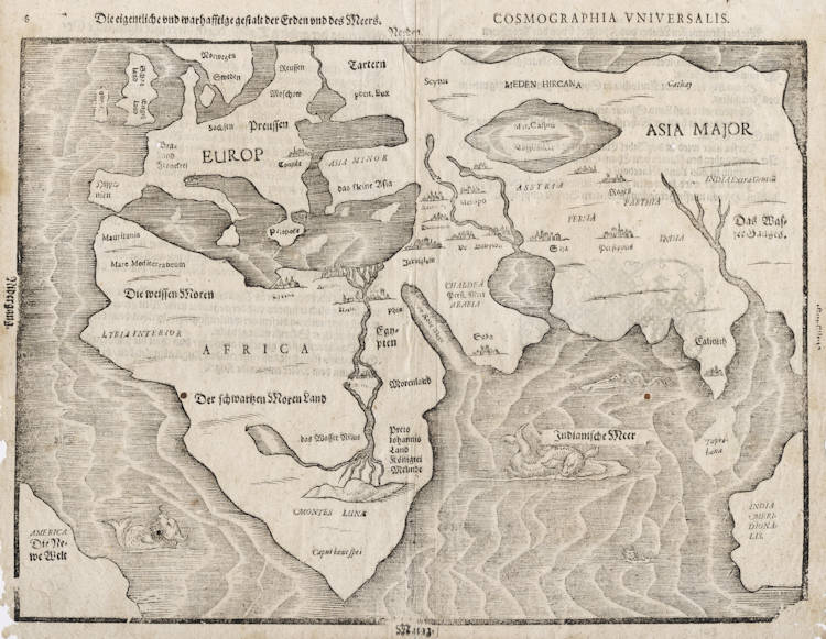
Paper slightly mellowed and margins frayed as usual. A very authentic collector's example, not bleached or washed. This is the rare second woodblock used for the map, used from 1595 onwards, when this different block was made. The main difference is that toponyms have been added in Europe and the Mediterranean Sea is now named. In 1650 a third and final woodblock was made.
The Mapping of the World
Heinrich Bünting, a theological commentator from Hanover, first published his Itinerarium in 1581. It is illustrated by several curious woodcut maps.
Bünting's book was reprinted at least ten times in several languages throughout the next seventy years. At least two further sets of blocks were produced, in addition to normal variations in the type occurring, as it was usually inset separately into the wood blocks.
(Shirley)
Heinrich BUNTING
DIE EIGENTLICHE UND WARHAFFTIGE GESTALT DER ERDEN UND DES MEERS (1581)
270 x 360 mm
First published in Itinerarium Sacrae Scripturae, Magdeburg, 1581.
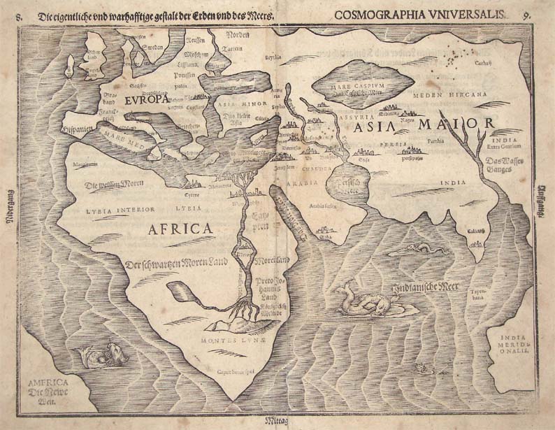
Bünting's map charts a landmass named India Meridionalis (Southern Indies), which strikingly resembles Australia's west coast. Shown to be in roughly the correct position, its presence is thought by some to indicate the possible Portuguese knowledge of Australia prior to the Dutch discovery in 1606. Given the general inaccuracy of the rest of the map, such an assertion should be made with some caution.
The map is rather crudely drawn, most of the shapes of the continents being fairly rudimentary. Nevertheless, the map remains a favourite amongst collectors. An early representation of America is shown and the Caspian Sea is greatly exaggerated in size.
The Mediterranean Sea is linked to the Black Sea by a waterway that extends all the way through Europe, presumably to the Arctic. Taprobana (Ceylon) is labelled but no landmass is charted. The seas are adorned with sea monsters and many major cities are indicated and named.
(Simon Dewez)
Heinrich Bünting (1545 – 1606)
Heinrich Bünting (1545 – 1606) was a Protestant pastor and theologian. He is best known for his book of woodcut maps titled Itinerarium Sacrae Scripturae (Travel book through Holy Scripture) first published in 1581.
Bünting was born in Hannover, Germany, in 1545. He studied theology at the University of Wittenberg graduating in 1569 and became a Protestant pastor in Lemgo. He was dismissed in 1575 and moved to Gronau an der Leine. In 1591 he was appointed superintendent in Goslar. When a dispute arose over his teachings in 1600 he was dismissed and retired from the ministry. He spent the rest of his life as a private citizen in Hannover.
His collection of woodcut maps, Itinerarium Sacrae Scripturae, first published in Magdeburg in 1581, was a very popular book in its day. It was reprinted and translated several times. The book provided the most complete summary of biblical geography available and described the Holy Land by following the travels of various notable people from the Old and New Testaments. In addition to conventional maps, the book also contained three figurative maps; the world depicted using a cloverleaf design thought to possibly represent the Trinity with Jerusalem in the center, Europe in the form of a crowned and robed woman, and Asia as the winged horse Pegasus.
(Wikipedia)
Related Categories
Related Items
